Vista View Mapping Tool Offers Customizable, Self-Service GIS Mapping Experience
Vista Site Selection brings an enormous trove of site selection data and analytics to users’ fingertips with the Vista View mapping tool. This interface allows users to create custom GIS maps by mixing and matching an array of data layers, ranging from demographics to infrastructure or, for a bit of fun, “Easter Egg” layers. The tool promises an intuitive experience for just $500 per month, far below the traditional GIS platform rate.
Vista View’s interface was designed to offer an intuitive experience for those trying GIS for the first time, while featuring functionality that experienced users expect.
What type of project is Vista View ideal for? You name it. We’ve provided a wide range of data layers and we can create custom layers for your unique project needs.
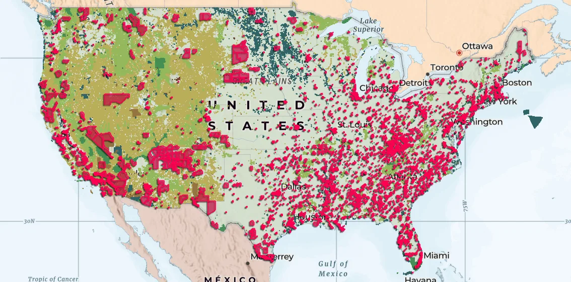
We’ve broken these data layers down into seven broad categories:
- People: Get to know an area’s population by studying a spectrum of demographic data or consider the region’s growth projections.
- Places: Learn more about amenities and services in the region, including school systems, medical facilities and shopping centers.
- Boundaries: Easily discern what sits where, thanks to provided boundaries at every level from federal lands to individual ZIP code.
- Infrastructure: Road networks, energy sources, water sources…Vista View maps the infrastructure critical for your project.
- Earth: Data layers such as soil type and wetland areas allow you to understand the opportunities, and limitations, of the local landscape.
- Weather: NOAA-sourced data gives insights into risks posed by floods and other weather events.
- Easter Egg: Take a break and check out Easter Egg, a fun, ever-changing layer that shows what the Vista Site Selection team can do, such as fast-food chain growth models. It might inspire you to think about what custom data layers we can make for your unique needs!
Once you’ve got the data you need, Vista View makes it simple to share notes and findings among the decision-makers on your team. Annotate and share your maps in a variety of formats.
Vista View has made professional GIS software accessible to a new generation of businesses. Reach out now and learn more about how it can transform your site selection process.
Recent Posts
See All
Jeff Troan Explains Leveraged Zoning in New Video
Jeff Troan, partner and senior managing director at Vista, explains the concept of leveraged zoning in our new video, “The Art of Work.”
Read more →
Vista Discusses State Government Site Selection Programs at Economic Development Incentives Conference
Vista Site Selection co-sponsored the 2026 Vorys Economic Development Incentives Conference and led several sessions, including “Exploring State Site Programs and Their Impact on Economic Development,” a panel where Vista’s managing director & head of incentives compliance, Julie Miller, chatted with representatives from Ohio and Pennsylvania about the state-sponsored site selection programs they represent.
Read more →
Vista Discusses Commercial Real Estate Trends at Economic Development Incentives Conference
Vista Site Selection co-sponsored the 2026 Vorys Economic Development Incentives Conference in Columbus, Ohio on February 28. Today’s entry focuses on “Commercial Real Estate Trends in 2026,” a panel where, Vista’s senior managing director, Matt Samler, chatted with experts on where they see the industry commercial development headed.
Read more →Want to learn more?
Get in touch with the Vista team to discuss how we can help with your next project.